Sant'Alenixedda district

Immagine per l'APP
Quartiere Sant'Alenixedda
Categoria/Sottocategoria
macrocategoria
Descrizione

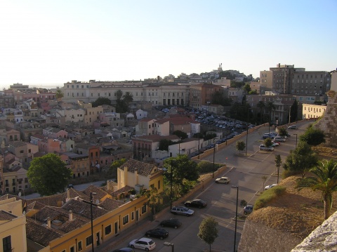
The Sant'Alenixedda district is between Giovanni XXIII Square, Ottone Bacaredda Street and Marconi Avenue. It takes its name from the homonymous street where the Lyric Theater of Cagliari and the "Pierluigi da Palestrina" Music Conservatory with the adjacent Auditorium are located. Although it is among the most populated neighbourhoods in the city, it has an uneven and not very compact appearance; in fact, to designate the area the denomination "Sant'Alenixedda" is used very rarely by its inhabitants who rather claim to belong to the adjacent neighbourhoods San Benedetto or Fonsarda.

Indirizzo
Quartiere Sant'Alenixedda
Poligono GEO

Quartiere Sant'Alenixedda

Quartiere Sant'Alenixedda

Quartiere Sant'Alenixedda

Fascia età
Fuori Cagliari
No
Quartiere
usato per affollamento
No
da usare solo per eventi e percorsi
Off
Comune
Immagine per il Portale
Quartiere Sant'Alenixedda

Add new review

Your review will be visible after approval by the editors

To post a review you must be an authenticated user.
Log in with Social Login

San Michele district

Immagine per l'APP
Quartiere San Michele
Categoria/Sottocategoria
macrocategoria
Descrizione

The San Michele district develops around the homonymous square. The main street also is via San Michele. It was originally built in the early decades of the twentieth century within the Carboni family farm which extended from Monastir Avenue and beyond San Michele Square. There is still the villa Carboni, dating back to the seventeenth century. This area of the city also houses the Church of the Miraculous Medal and the district’s cemetery.

Indirizzo
Quartiere San Michele
Poligono GEO

Quartiere San Michele

Quartiere San Michele

Quartiere San Michele

Fascia età
Fuori Cagliari
No
Quartiere
usato per affollamento
No
da usare solo per eventi e percorsi
Off
Comune
Immagine per il Portale
Quartiere San Michele

Add new review

Your review will be visible after approval by the editors

To post a review you must be an authenticated user.
Log in with Social Login

San Giuliano district

Immagine per l'APP
Quartiere San Giuliano
Categoria/Sottocategoria
macrocategoria
Descrizione

The district of San Giuliano is located under the eastern slopes of the hill of Monte Urpinu, in whose northern slopes stood the Benedictine monastery of San Giuliano (of which no trace remains) and ends on the banks of the channel that delimits the Molentargius pond on this side. It is an integral part of the Genneruxi neighbourhood.

Indirizzo
Quartiere San Giuliano
Poligono GEO

Quartiere San Giuliano

Quartiere San Giuliano

Quartiere San Giuliano

Fascia età
Fuori Cagliari
No
usato per affollamento
No
da usare solo per eventi e percorsi
Off
Comune
Immagine per il Portale
Quartiere San Giuliano

Add new review

Your review will be visible after approval by the editors

To post a review you must be an authenticated user.
Log in with Social Login

San Benedetto district

Immagine per l'APP
Quartiere San Benedetto
Categoria/Sottocategoria
macrocategoria
Descrizione

The San Benedetto district was built in the 1930s when the first edifices were erected near the main square which gave life to the original housing complex.
Twenty years later, due to the massive demand for new homes by citizens who had lost theirs during the war, the neighbourhood was the protagonist, together with other districts of the same city, of a rapid building expansion that saw it grow and occupy areas that until then were entirely peripheral. The construction of the palaces was completed in a few years and San Benedetto assumed, on the map of Cagliari, the current polygonal shape, with the center in the homonymous square and vertices corresponding to other central points of the city, the squares: Repubblica, Garibaldi and Dante (later dedicated to Pope John XXIII from Palestrina).

Indirizzo
Quartiere San Benedetto
Poligono GEO

Quartiere San Benedetto

Quartiere San Benedetto

Quartiere San Benedetto

Fascia età
Fuori Cagliari
No
Quartiere
usato per affollamento
No
da usare solo per eventi e percorsi
Off
Comune
Immagine per il Portale
Quartiere San Benedetto

Add new review

Your review will be visible after approval by the editors

To post a review you must be an authenticated user.
Log in with Social Login

San Bartolomeo district

Immagine per l'APP
Quartiere San Bartolomeo
Categoria/Sottocategoria
macrocategoria
Descrizione

San Bartolomeo extends along the entire homonymous avenue. The neighbourhood, utilized for residential houses, is divided into two areas: the higher, a more recent area - which includes Francesco Alziator Street, Francesco Loddo Canepa Street, Renato Prunas Street, Rafaelo Delogu Street - and the lower one, an older area which includes San Bartolomeo Street, Vergine di Lluc Street and Piazza San Bartolomeo, where there is also the seventeenth-century church of Saint Bartolomeo.

Indirizzo
Quartiere San Bartolomeo
Poligono GEO

Quartiere San Bartolomeo

Quartiere San Bartolomeo

Quartiere San Bartolomeo

Fascia età
Fuori Cagliari
No
Quartiere
usato per affollamento
No
da usare solo per eventi e percorsi
Off
Comune
Immagine per il Portale
Quartiere San Bartolomeo

Add new review

Your review will be visible after approval by the editors

To post a review you must be an authenticated user.
Log in with Social Login

Poetto district

Immagine per l'APP
Quartiere Poetto
Categoria/Sottocategoria
macrocategoria
Descrizione

The Poetto district takes its name from the famous seaside resort which stretches for about four kilometers, from the Sella del Diavolo (Devil’s Saddle) to the beginning of the coast of Quartu Sant'Elena. The area between the beach and the Molentargius saltworks is inhabited by numerous residents but it is it is invaded by tourists especially during the summer months. The main economic activity of the neighbourhood was linked to the extraction of salt; the extraction plants remained active until the eighties of the twentieth century. According to different interpretations, the origin of the name Poetto would depend on a Spanish tower, called “of the poet” or it would derive from the presence of ancient wells and cisterns extant on the Sella del Diavolo for the collection of water.

Indirizzo
Quartiere Poetto
Poligono GEO

Quartiere Poetto

Quartiere Poetto

Quartiere Poetto

Fascia età
Fuori Cagliari
No
usato per affollamento
No
da usare solo per eventi e percorsi
Off
Comune
Immagine per il Portale
Quartiere Poetto

Add new review

Your review will be visible after approval by the editors

To post a review you must be an authenticated user.
Log in with Social Login

Mulinu Becciu district

Immagine per l'APP
Quartiere Mulinu Becciu
Categoria/Sottocategoria
macrocategoria
Descrizione

The Mulinu Becciu district extends in the north western part of Cagliari, after Sant'Avendrace and San Michele. It underwent a significant development starting from the eighties, hosting partly public housing buildings and partly residential buildings. It stands on a slightly hilly area, that in the past was used for the cultivation of vines and mills were also built for the millstone that give the neighbourhood its name.

Indirizzo
Quartiere Mulinu Becciu
Poligono GEO

Quartiere Mulinu Becciu

Quartiere Mulinu Becciu

Quartiere Mulinu Becciu

Fascia età
Fuori Cagliari
No
Quartiere
usato per affollamento
No
da usare solo per eventi e percorsi
Off
Comune
Immagine per il Portale
Quartiere Mulinu Becciu

Add new review

Your review will be visible after approval by the editors

To post a review you must be an authenticated user.
Log in with Social Login

Monte Urpinu district

Immagine per l'APP
Quartiere Monte Urpinu
Categoria/Sottocategoria
macrocategoria
Descrizione

The Monte Urpinu district takes its name from the homonymous hill. Shortly located from the center, it is characterized by the presence of a large green area and the panoramic road called Europa Avenue. It was built starting in the 1950s as the new residential district of the city and experienced its maximum expansion in the 1970s. It houses the Binaghi hospital.

Indirizzo
Quartiere Monte Urpinu
Poligono GEO

Quartiere Monte Urpinu

Quartiere Monte Urpinu

Quartiere Monte Urpinu

Fascia età
Fuori Cagliari
No
Quartiere
usato per affollamento
No
da usare solo per eventi e percorsi
Off
Comune
Immagine per il Portale
Quartiere Monte Urpinu

Add new review

Your review will be visible after approval by the editors

To post a review you must be an authenticated user.
Log in with Social Login

Monte Mixi district

Immagine per l'APP
Quartiere Monte Mixi
Categoria/Sottocategoria
macrocategoria
Descrizione

The small Monte Mixi district is located between Viale Diaz and the sports facilities of Rockefeller Street. It was built on a hill of modest size, called Monte Mixi. It borders the districts of Bonaria, Monte Urpinu, La Palma and Sant'Elia.

Indirizzo
Quartiere Monte Mixi
Poligono GEO

Quartiere Monte Mixi

Quartiere Monte Mixi

Quartiere Monte Mixi

Fascia età
Fuori Cagliari
No
Quartiere
usato per affollamento
No
da usare solo per eventi e percorsi
Off
Comune
Immagine per il Portale
Quartiere Monte Mixi

Add new review

Your review will be visible after approval by the editors

To post a review you must be an authenticated user.
Log in with Social Login

Marina district

Immagine per l'APP
Quartiere Marina
Categoria/Sottocategoria
macrocategoria
Descrizione

The Marina district is one of the four historic districts of Cagliari. Its boundaries are delimited to the north by the walls of Castello, to the south from Roma street, to the east from Regina Margherita Avenue and to the west from Largo Carlo Felice.

Its origins date back to the times of the Pisan domination; it arose as an area intended to house the warehouses and the dwellings of the workers of the port. 

The initial name was Lapola and the neighbourhood was equipped with a defensive system of walls and bastions, modernized by the Spaniards and demolished in the second half of the nineteenth century.


Indirizzo
Quartiere Marina
Poligono GEO

Quartiere Marina

Quartiere Marina

Quartiere Marina

Fascia età
Fuori Cagliari
No
Quartiere
usato per affollamento
No
da usare solo per eventi e percorsi
Off
peso
Comune
Immagine per il Portale
Quartiere Marina

Add new review

Your review will be visible after approval by the editors

To post a review you must be an authenticated user.
Log in with Social Login